[DISPLAY_ULTIMATE_SOCIAL_ICONS]
Updated Google Earth Imagery
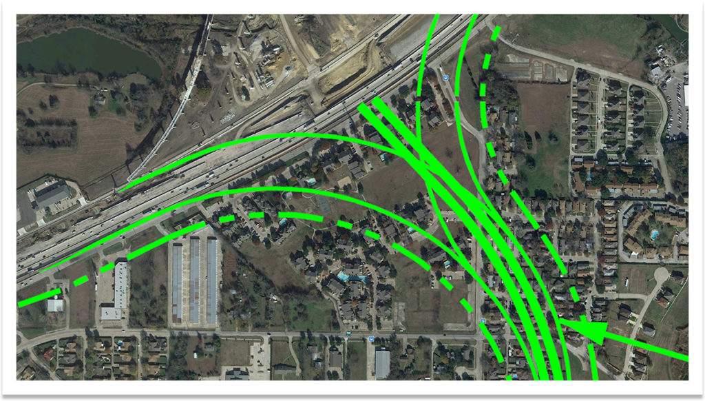
Today I ran across new Google Earth imagery of the construction site. Based on my photos it looks to be from mid-November 2009. It’s pretty cool to see things in the two totally different perspectives. I also decided to overlay the 2007 alignments on to the new imagery. It’s not exact, but the illustration gives a very good idea of what structures and land are in the East Branch’s path.
Overall, construction has slowed due to rain and record snow. I haven’t visited the site on foot in a while … which means no new photos YET. I see new progress every other week or so and I’m anxious to get over there. Lots of new girders have been raised and the first few sections of direct-connect bridge roadway are extending over the lake. New photos will be coming soon!

Pre-construction

Post-construction – Mid-November 2009

Schematics from 2007 Alignment Map overlaid on updated imagery. The dotted line represents the closest a structure or private land can be to the roadway.
All photographs © 2008-2011 JA2 Photo, All Rights Reserved. If you would like information on acquiring commercial licensing and printed media contact me directly.